The post Photo Archives and Maritime Cliches appeared first on Shipwrecks and Submerged Worlds.
]]>
During last week’s Tweetchat @agi_mv asked about the use of satellite technology in identifying submerged sites and shipwrecks. The discussion that followed ended up on the beaches of south India about 10 years ago, beaches which Julian had identified kattumaram boats on from GoogleEarth images and on which Lucy, Julian and I (along with Dr Colin Palmer, Dr Selvakumar and a handful of other fantastically patient Indian colleagues) spent some weeks recording and researching fishing boats.
@JesseRansley @rjulianw Of course. Where would romantic/adventurous cliches of maritime archaeology otherwise come from? Photo evidence? ;)
— Ági MV (@agi_mv) February 4, 2016
@agi_mv’s comment about the images that project conjured up and some of the romantic clichés of maritime archaeology got me thinking.[1]
We could probably all name a few of the clichés and visual tropes that surround maritime archaeology: the dives on intact shipwrecks in crystal blue seas; divers surfacing, breaking the waves with crucial artefacts in their hands; the technology pinging and effortlessly producing perfect surveys of exactly what is on and in the seabed.[2] Most of the time, however, it is largely about mud, mud and soggy wood if you are lucky, but definitely mud and laptops on desks in messy offices.
In maritime ethnography and ethnoarchaeology, which we’ll be discussing further in Week Four, the photographs we take are documentary. They form a core part of the project archive. They are also often a source of a different set of ‘romantic cliches’ and visual tropes: sandy beaches, rough-hewn boats, palm trees, local fishermen and boatmen, big skies… a timeless idyll or holiday paradise in which any researcher would want to work.

In the last few years, archaeologists have been increasingly interested in their project archives as an object of study in themselves. They’re no longer looked at simply as ‘neutral’ records of a project or site. We’re starting to recognise the people behind the archives – the choices that are made of what to record, what to include, what to disregard – and how those choices shape the apparently ‘neutral’ record. We’re looking for traces of the historical and social context in which they were made.[3]
Some of which might sound like a lot of navel-gazing – but it is very important to maritime ethnoarchaeology in particular. There is a lot to be found behind questions like: who is doing the recording? Who gets to choose what is important and should be photographed? How are these images used? And, who is viewing and commenting on them? And perhaps most importantly, are fishermen being recorded as ‘objects’ alongside their boats?
The assumptions we make as viewers of photographs are of particular importance. What do we see beyond boats on a beach? Do our ideas about ‘traditional fishermen’, Indian lives and culture shape what we see? What historical, social and cultural ideas do we unconsciously draw on to understand the image? Do the fishermen (or the researcher) have any say in how they are represented?
In postcolonial contexts, the power dynamics at play in idyllic images like the one above are striking. Ideas about the tensions between ‘modern’ and ‘ancient’, between urban and rural, about race, postcolonial dynamics and even economic and intellectual power, are swirling around these photos and in the ways in which we use and look at them.
This is a problem that ethnographers and maritime ethnoarchaeologists still grapple with. How can the people (researcher and fisherman alike) within the photographs be more than stereotypes? How can we make sure the people we study are able to represent themselves within our work? How can projects be collaborations, shaped by both the community and researcher?
These are complicated methodological and philosophical problems for researchers, particularly if they are interested in intangible heritage, like boat building and maritime traditions.
There’s an awful lot at stake within some of those ‘romantic’ images of maritime ethnoarchaeology.
So, in readiness for tonight’s Tweetchat (between 8-9pm tonight, #FLShipwrecks), I have a few questions for you:
- What do you think are the biggest clichés of maritime archaeology?
- Have you ever thought of any of them as destructive or dangerous?
- And, what image or photograph best sum-up maritime archaeology for you?
[1] In fact, there is a photo essay and research paper being formulated as we speak as a result – thank you @agi_mv.
[2] I’ve written about some of this from a different angle here.
[3] There was a very good ‘Archives Issue’ of the Archaeological Review from Cambridge in 2014. The introduction to the volume can be found here.
The post Photo Archives and Maritime Cliches appeared first on Shipwrecks and Submerged Worlds.
]]>The post Material seas appeared first on Shipwrecks and Submerged Worlds.
]]>
In the last week I’ve spent an improbably large amount of time thinking about various philosophical conceptions of maritime space. This is due partly to Monday’s British Waters and Beyond: The cultural significance of the sea since 1800 at the Royal West of England Academy in Bristol, and partly to my increasing obsession with sailing directions.
With our paper at the symposium on Monday and a final article out (we hope) next year, Hannah Cobb and I are coming to the end of a small philosophical adventure into maritime space.
Amid the recent material turn in the Humanities, the need to reconsider our understandings of seas and oceans has become apparent. Across the diverse philosophical conceptions deployed in disciplines from geography to law and literature, there’s a provocative tension growing between aesthetic and material imaginings of maritime space. Yet the former is proving increasingly problematic when we try to move beyond metaphor to material seas and oceans, and particularly when we want to address human habitation of watery worlds.

Hannah and I have been exploring what archaeology and anthropology can bring to this discussion. Using a little of what Jane Bennett termed, rather wonderfully, a ‘countercultural kind of perceiving’ (i.e. not anthropocentric, but attentive to things and their affects), we started with seascapes and moved quickly on to assemblages and material seas.
I’m not sure this exploration of material seas is quite over for me though, because I keep coming back to my Channel Pilot. It’s a huge volume published by the UKHO that offers sailing directions for the English Channel and its western approaches through a combination of text and charts. At 504 pages my 2005 edition is comprehensive – you couldn’t call it a handy guide. But for me it’s spellbinding because its dense bulk reflects perfectly the problem of trying to pin down the experience of sailing within a dynamic environment, where places (confluences, sandbanks and fishing grounds) shift with season, tide and weather.

Maritime geography is underpinned by real-world experience, a lived knowledge that is as much about intuiting and interpreting the world at that moment as it is about depth, current and tide. This experiential knowledge is gained through the bodily practices of wayfinding and navigation at sea and all the multisensory engagements – with currents, winds and weather and with instruments of measurement, the bodies of other sailors and the ship itself – involved in the tasks of seafaring in a weather-world.
Codifying these embodied understandings of maritime places and attempting to produce an externalised hydrography suitable for transmission via text, diagram and chart is therefore no small feat – and produces, perhaps inevitably, a hefty tome.
The post Material seas appeared first on Shipwrecks and Submerged Worlds.
]]>The post Maritime Bus appeared first on Shipwrecks and Submerged Worlds.
]]>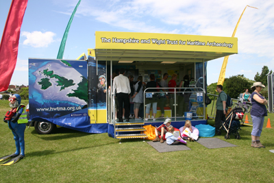
Maritime Bus
Last week the Maritime Bus came to the Avenue Campus on a University Open Day to provide an insight into maritime archaeology for prospective undergraduate students, and to give current postgraduate students training and experience in outreach activities. The Maritime Bus is the only archaeology-themed exhibition of its kind in the UK. It was originally part of the Heritage Lottery Funded Engaging New Audiences project, which ran from 2009 to 2012, and has since then continued to bring maritime archaeology to thousands all over the country.
The Bus itself is filled with information boards, a collection of artefacts for handling, touch-screen computers, a microscope corner, books, mini-ROVS, mini-Airlifts, and lots of other activities. At the end of the day, everything packs away into the back of the bus – the roof folds down and the stage folds up – making it incredibly mobile.
I got involved with the Maritime Archaeology Trust, and then the Maritime Bus, several years ago after MAT staff visited my college for a talk about maritime archaeology, and after the talk I asked to be involved. A few months later I was invited to be part of the Maritime Bus Crew, and I spent the next three years volunteering on it whenever I could. The Maritime Bus went all over the country, and even abroad to France, the Netherlands and Belgium, to a range of schools, clubs, events and shows.
I now work for the Maritime Archaeology Trust, and the Maritime Bus is still one of my favourite parts of the job. Not only is it fun and unique, but it gives people the chance to really engage with maritime heritage in a very hands-on way. When I tell someone they’re holding a 16,000 year old handaxe, the reaction is one you simply don’t get if they were looking at it in a glass case in a museum. That’s part of what makes the Maritime Bus so special: the barriers are removed and with the help of staff and an enthusiastic cohort of volunteers, visitors are treated to an experience that is not quickly forgotten.
If you’re interested in volunteering with the Maritime Archaeology Trust – on the Maritime Bus, in education and outreach, research, fieldwork or diving – please email Caroline at cbs@maritimearchaeologytrust.org.
The post Maritime Bus appeared first on Shipwrecks and Submerged Worlds.
]]>The post Communicating Above Water appeared first on Shipwrecks and Submerged Worlds.
]]>I am on my way back from an interesting conference on ‘Offshore Industry and Archaeology’ held in Esbjerg and sponsored by the Offshore Centre, Denmark and Syddansk University. It is unusual to get Industry and Archaeology to sit and talk, and the financial figures casually cited by the industry delegates were enough to make an archaeologist feel very small indeed. Our conference sponsors reported a 50+ billion DKK (more than £5 billion) turnover in oil and gas and a similar amount in offshore renewables in 2011. These figures may make us feel small, but as archaeologists we must not forget that these big companies still need us, we are important. The consideration of underwater cultural heritage (UCH) and environmental impact assessments (EIAs) are prerequisites in their work, so we must learn to communicate. UCH is clearly protected in international law for e.g. the UN Convention on the Law of the Sea 1982 (Art. 149 & Art. 303) and the UNESCO Convention 2001, which whilst slow to be adopted, directly addresses activities that ‘incidentally affect’ UCH such as the offshore industry (Articles 5, 9 & 10). Within these conventions are multiple distinctions and a complex web of jurisdiction creating a fine balance between access to resources on the continental shelf and protection of them. Whether the UNESCO Convention 2001 is adopted or not, will come down to the objections and concerns that can be made, or dispelled, by different readings of the articles – a semantic problem. But, these questions as to connotation were not the only linguistic barrier in the room last week, it was the communication between the archaeologists and the industry delegates that called for a translator. Not, of course because we emanated from far and wide geographically, but because we do so culturally, and if we are to build our relationships and work as partners in the offshore environment we need to learn to speak the same language. The offshore industry wants to minimize ‘risk’. For them this signifies unexpected (read expensive) delays to their projects caused by the sudden discovery of archaeology on the seabed. For us, ‘risk’ focuses upon potential damage to the UCH and the ensuing loss of knowledge about our past. As such, for industry, involving archaeologists in the very earliest planning stages of their projects, working closely with us and collecting data at a high enough resolution for archaeological interpretation can mean that they have no ‘nasty’ surprises and expensive delays when they start building. Equally this means that as archaeologists we can protect the UCH and develop a good relationship with industry that enables us to share data for research purposes. It is a symbiotic relationship. Just clarifying meaning and initiating these discussions is a good start towards building good relations, but only the start. In Esbjerg this week, many of these Industry representatives flew in and out to deliver their company’s public relations presentation. It is a great start that they came, but a shame that they could not stay for the discussion. We can make inroads into speaking the same language, but listening is still key.
And finally, remaining on this theme of language and listening, I am back in the (soon to be ex) heartland of the BBC in White City tomorrow learning how to interview and be interviewed. I will take note from this week’s meetings and make sure that I am not one of those interviewers who are so stuck on their agenda that they do not listen to the answers (not mentioning names, Radio 4). This is to be followed by vocal coaching, so if you hear me speaking differently this week it may be Received Pronunciation or may just be that the vocal coach is preparing us for a move to Salford.
The post Communicating Above Water appeared first on Shipwrecks and Submerged Worlds.
]]>The post The Portus Project: Surveys, Simulations, and Story Telling appeared first on Shipwrecks and Submerged Worlds.
]]>The Portus Project has been surveying, excavating, simulating and presenting the Roman port of Portus (Fiumicino) for more than a decade. Portus was the maritime port of ancient Rome and, together with the neighbouring river port at Ostia, was the focus of a network of ports serving Imperial Rome between the mid-1st century AD and the 6th century AD. It was established by the Emperor Claudius in the mid-1st century AD, enlarged by Trajan, and subsequently modified during the 3rd and 4th centuries AD.
The Portus Project has employed a wide range of digital technologies to assist in the fieldwork, to develop new interpretations and to communicate its findings to a wide audience. The great extent and complexity of the site and surrounding landscape of Portus requires a multi-faceted approach to their study. For example, we use a wide range of methods to explore the archaeology laying both above, and below, the ground. Processes such as photogrammetry, laser scanning and reflectance transformation imaging (RTI) allow researchers to examine, record and present the surface layers of the site and its artefacts in extraordinary detail. Other technologies, such as ground-penetrating radar, sidescan sonar, and magnetometry give archaeologists the capacity to see into the earth and chart future excavations.

Taking near-IR photographs at Portus
Computation has been at the heart of attempts to integrate data and interpretation, and to communicate the complexities of the site to a wide audience. For example, the Portus Project is employing computer graphics for four separate purposes. Firstly, these tools are being used as mechanisms to integrate the diverse spatial data gathered via our research. For example, we are combining three-dimensional geophysics with laser scans and excavated sections to understand the development of the Building 5. Secondly, computer graphics provide a means for developing interpretations of the data. At the corner of the surviving cistern complex (Palazzo Imperiale II) such simulation has helped us to understand how water may have been moved between the harbour buildings. Thirdly, they are being applied towards formal analysis of the site, for instance in terms of structural analysis, studies of lighting, and assessment of the use of space at the port. Finally, still, animated and interactive computer graphics are enabling the project to communicate its interpretations widely. In addition to creating these visuals, we are researching the role that visuals have played and continue to play in the representation of the site.
You can learn more about the Portus Project at www.portusproject.org
The post The Portus Project: Surveys, Simulations, and Story Telling appeared first on Shipwrecks and Submerged Worlds.
]]>